Floodplainletter-2

Verify Your Flood Zone Designation – A Cautionary Tale from The Ozarks

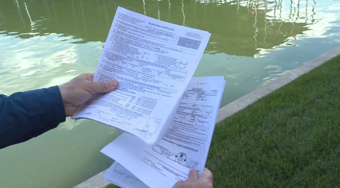
Welcome to The Ozarks, and in particular, the Camden County, Missouri, communities surrounding the Lake of the Ozarks, where FEMA’s revised -and many would say “flawed” – flood maps serve as a cautionary tale for property owners: Verify your flood zone designation! Courtesy of KY3 (Springfield, MO), here’s their story: CAMDENTON, Mo. — “They have […]

Flood Risk News & NotesvFIS

Flood Risk News & Notes: Rates, Maps, Regulatory and Elevation Matters

From the headlines to your bottom line, this edition of Flood Risk News & Notes includes another extension of the National Flood Insurance Program (NFIP); an increase in flood insurance premium rates; flood map changes in more than 70 communities around the country; and a reminder about elevation certificates. Below you will find a summary […]

Flood Map Update Front-Generic-NB

This Month, Check Last Month’s Flood Map Updates – 42 Communities Affected

FEMA’s release of revised flood insurance rate maps includes 42 communities in seven states: Florida, Georgia, Louisiana, New York, Oregon, Texas, and Washington.  Many flood map updates place homes and buildings in a Special Flood Hazard Area (SFHA), also known as a high-risk flood zone. A flood map reflects a geographic area -not individual property […]

Flood Map Update Front-Generic-NB

November 2017 Flood Map Updates

On November 3, 2017, the Federal Emergency Management Agency (FEMA) released revised flood insurance rate maps for select communities in three states: New York, Pennsylvania, and Iowa. The new maps place many homes and buildings in a Special Flood Hazard Area (SFHA), also known as a high-risk flood zone. A flood map reflects a geographic […]